SERVICES
Orthoimagery
ASI offers premier orthoimagery acquisition and processing services for a wide variety of applications. Our digital orthoimagery is available at multiple resolutions and spectrums (RGB and 4-band). ASI uses technology from trusted aerial imagery brands like Vexcel and Leica to offer flexibility in acquisition. Our large format cameras provide maximum coverage of your AOI increasing efficiency in collection which saves our clients time and money.
Common Applications for ASI Orthoimagery
- Annual base map update
- Planimetric feature extraction
- Image analysis
- GIS base layer / Land base
- Engineering design
- Asset management
- Municipal and government maps
- Right-of-way mapping
- Environmental assessment
- Public & private land development
- Urban planning
- Watershed management
- Landscape architecture
- Agriculture / Crop science
Beyond Orthophotography
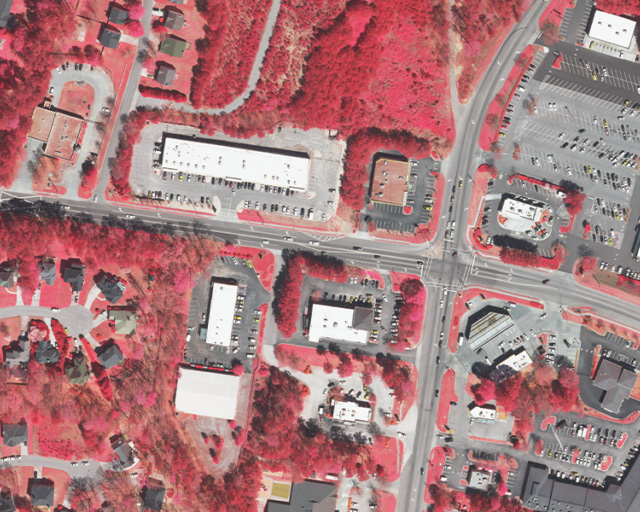
Near-Infrared Imagery (NIR)
Near-infrared imagery (NIR) captures wavelengths emanating from vegetation to produce a more detailed orthoimage for monitoring and analysis of vegetation, soil, and wetlands. In a NIR image, the internal cell structure of vegetation strongly reflects the NIR wavelength, providing a more robust indicator of plant health than the visible green wavelength reflection of chlorophyll in the leaves.
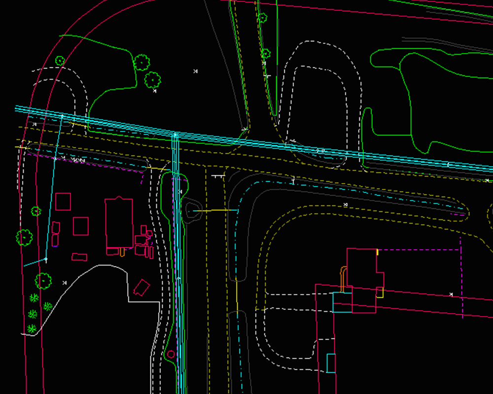
Planimetric Mapping
Planimetric mapping is the representation of natural or man-made features layered on a map. Features are extracted from orthoimagery data in the form of lines and polygons. There is a vast amount of information that can be derived from base map data which supports a multitude disciplines. ASI provides innovative solutions for extracting valuable information from base maps.
Anything visible in the orthoimagery can be digitized but common items found in planimetric maps include: Building footprints, Sidewalks, Street and curbs, Impervious surfaces, Utility lines, and Vegetation
View all the features we extract
Orthorectification
Imagery has an amazing amount of information, but raw aerial imagery cannot be used in for GIS until it has been processed such that all pixels are in an accurate (x,y) position on the ground. Orthorectification is the process of converting images into a form suitable for mapping by removing sensor and aircraft motion and terrain-related geometric distortions from raw imagery. The orthorectification process requires an accurate description of the sensor, detailed information about the sensor location and orientation for every image, and an accurate digital elevation model (DEM). After imagery has been orthorectified, it can be used within a GIS and accurately overlaid with other data layers
Layer-up Your Basemap
Your basemap imagery deserves layers. Our photogrammetry & GIS specialists can add above ground planimetric features, topographic contours, vector detail, and more. These additional layers add value to your data and help capitalize on your existing or future imagery.