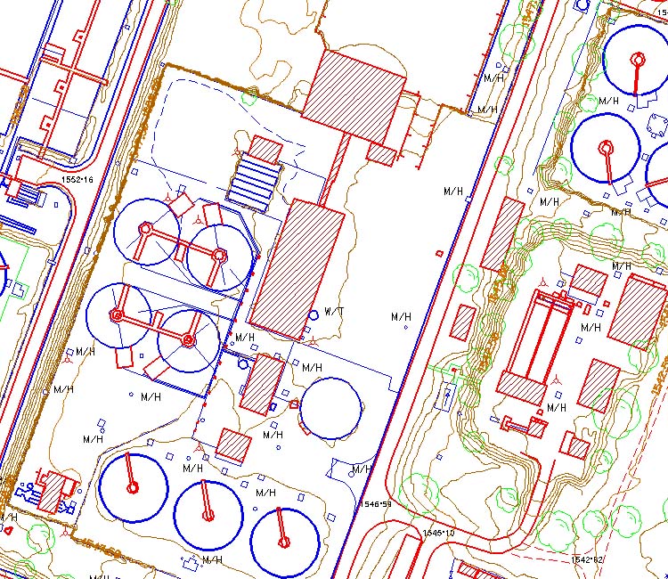
ASI provides rapid turnaround and high-quality mapping of feature conditions to assist utility engineers throughout the design/inspection process. We utilize the latest acquisition technology and processing software for modeling overhead lines, structures, terrain, and vegetation features.
Features extracted from lidar point clouds provide utility engineers critical data to model and calculate line ratings, element sag, and tension.
Electric Utilities
ASI provides rapid turnaround and high-quality mapping of feature conditions to assist utility engineers throughout the design/inspection process. We utilize the latest acquisition technology and processing software for modeling overhead lines, structures, terrain, and vegetation features. Features extracted from lidar point clouds provide utility engineers critical data to model and calculate line ratings, element sag, and tension.
Engineering / A&E
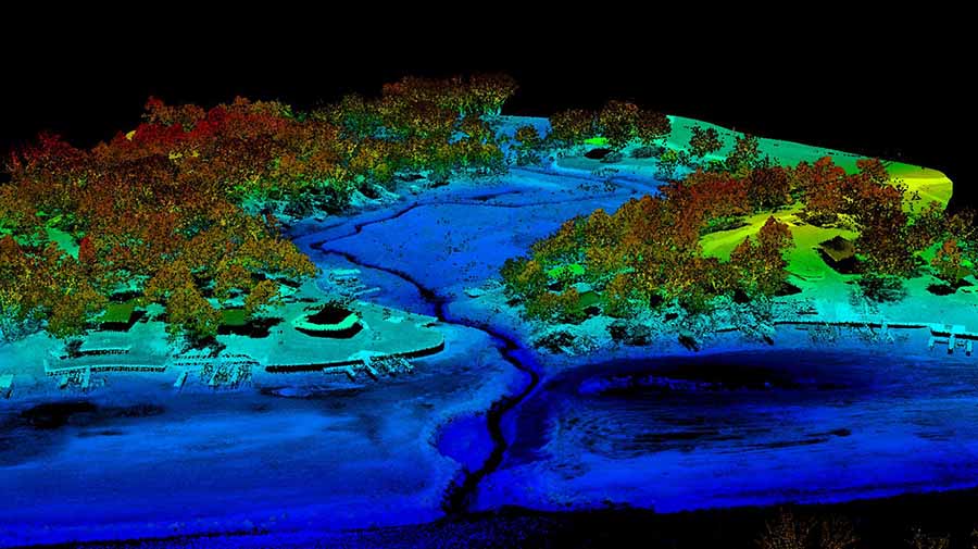
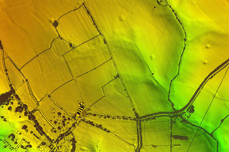
We help engineering firms nationwide with high-quality geospatial solutions such as aerial lidar, orthoimagery, and oblique imagery for a multitude of applications:
Wind/Solar Sites
Urban Planning/Development
Infrastructure
Roadway design/inspection
Natural Resources
Data is then processed to specification by lidar scientists or photogrammetry specialists. Common deliverables for these projects are:
Calibration
Classification
Planimetric
Topographic
Contours
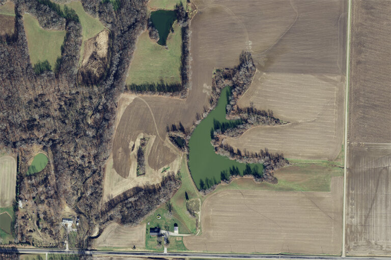
Forestry and Natural Resources
We provide aerial imagery, lidar, and mapping solutions for local, state, and federal government agencies managing forests, rivers, watersheds, wildlife habitats, and other public lands to support planning decisions, stewardship of lands, asset management, and monitor changes.
Government
We serve Local, State, and Federal governments with insightful data about our communities and natural resources. ASI has an extensive background working with federal agencies to collect data that promotes the good stewardship of our lands. ASI’s experienced, certified professionals have a robust background in working on large scale projects requiring specific standards and accuracies.
Our team is built of Project Managers, CPs, Certified Mapping Scientists, and GISPs. We have over 200 years of combined experience and we’ve built a comprehensive network of reputable firms that increase our capacity, capabilities, and reach. Having a versatile team enables ASI to strategically assign professionals to your project based on project requirements and specifications.
25+ Years of USDA Experience
National Resources Inventory (NRI Program)
Stewardship Lands (SL)
National Agriculture Imagery Program (NAIP)
USGS
ASI participated in the USGS 3DEP (3D Elevation Program) as a prime contractor. During this time ASI was awarded and completed multiple task orders, exceeding accuracy specifications and delivering on time. Our team of professionals collected & produced over 60,000 square miles of various quality levels of data across the nation.
Mining and Quarries
Commodity mines and aggregate quarries rely on accurate aerial imagery, lidar, and 3D modeling for critical information to keep operations running. We offer multiple acquisition methods to cost-effectively produce aerial surveys that assist mining professionals with:
Volumetric studies & stockpile analysis
Slope monitoring
Change detection
Assessing nearby vegetation health with 4-band near-infrared imagery.
Oil and Gas
Aerial Services provides orthoimagery, lidar and mapping data for the oil and gas industry, from pipeline/corridor mapping to facility infrastructure. We enable oil and gas companies to monitor site suitability, right of way route determinations, and other common operations effectively.
Transportation
We provide high-density lidar and low altitude photogrammetry to support a multitude of transportation projects.
From pre-design topographics to as-built infrastructure, pavement condition, and right-of-way mapping. Our teams empower Engineers and DOT’s with the critical data needed to plan and maintain transportation infrastructure.
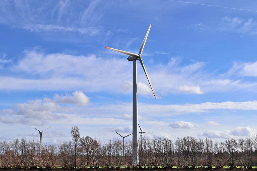
Renewable Energy
Aerial Services provides high-density lidar and orthoimagery of renewable energy sites to Engineering and power companies nationwide. Rapid turnaround from project discovery to delivery of data allows our clients to make important decisions faster, saving time and money.