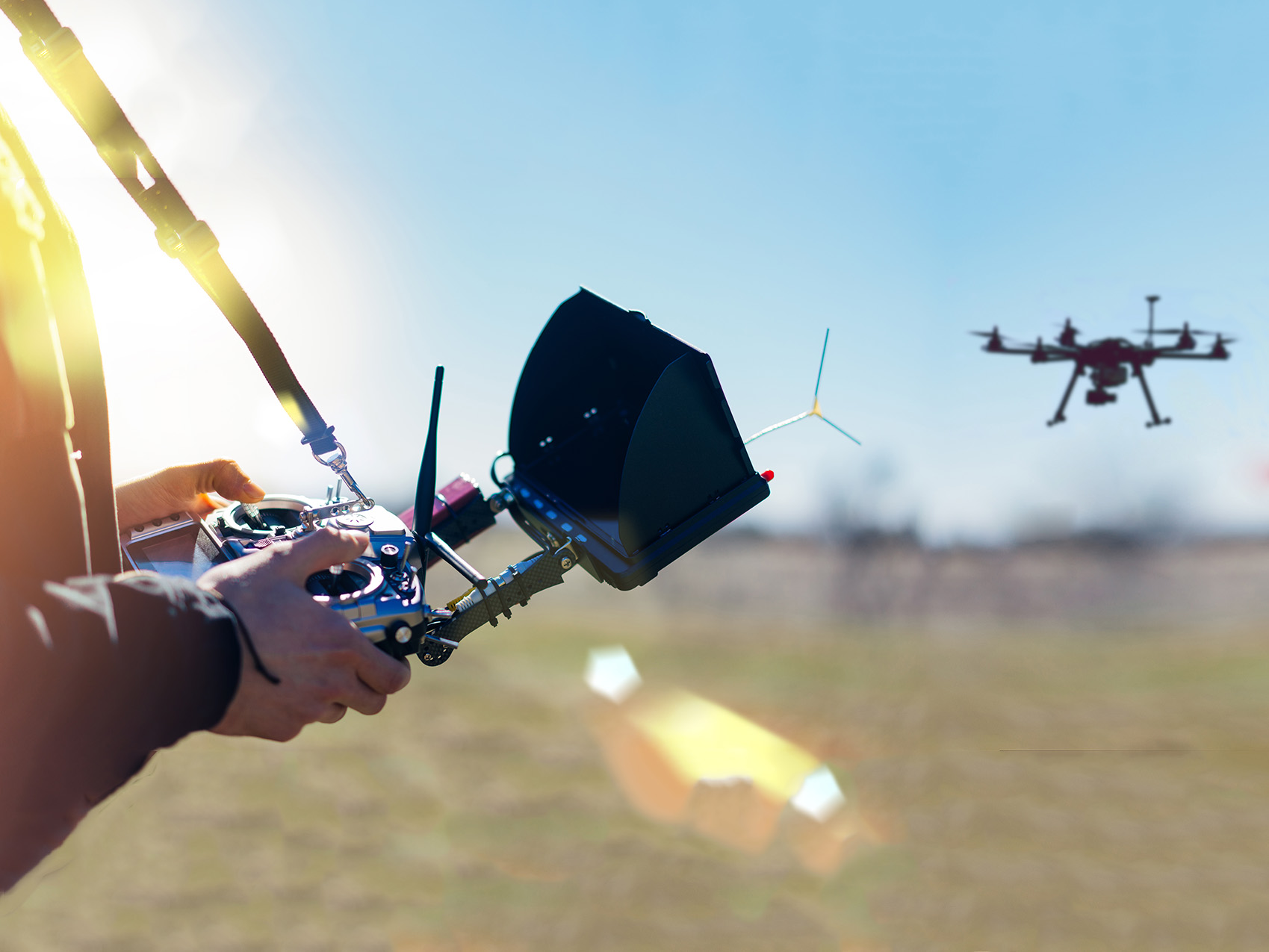
In the ever-evolving world of construction and infrastructure, the demand for accurate and efficient surveying data is paramount. Enter drones: the game-changers that have revolutionized as-built surveying. With their advanced technology and precise data collection capabilities, drones offer an array of compelling advantages over traditional methods. From enhancing efficiency and slashing costs to improving safety and delivering unrivaled data accuracy and visualization, drones have become the go-to tool for modern surveying practices.
In this blog post, we will delve into the transformative benefits of utilizing drones for as-built surveying, and explore how they are reshaping the construction industry as we know it.
 Unleashing Unmatched Efficiency
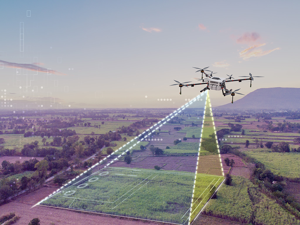
Traditional as-built surveying methods often involve laborious manual measurements and visual inspections, which can be very time-consuming. Drones, on the other hand, soar above physical barriers, swiftly covering expansive areas and expediting the data collection process. Equipped with state-of-the-art cameras, LiDAR technology, and advanced sensors, drones can capture intricate imagery and geospatial data from multiple angles and elevations. This minimizes the need for time-consuming manual measurements, empowering surveyors to obtain precise and comprehensive data with remarkable ease.
Moreover, drones armed with real-time imaging capabilities provide instant feedback, allowing surveyors to swiftly identify and rectify any discrepancies on-site. This real-time agility helps to minimize errors, boosting the overall accuracy of as-built surveying. By enhancing efficiency, drones not only save invaluable time but also facilitate seamless project progression, ensuring timely delivery.
Cost Savings Through Enhanced Efficiency
Surveying methods, traditional or modern, require substantial investments in equipment, manpower, and resources. However, the true cost savings lie in the significant efficiency gains achieved by incorporating drones into as-built surveying practices. A drone’s aerial capabilities allow them to navigate and capture data from vantage points that covers more ground than traditional methods.
 Another key aspect contributing to cost savings is the seamless processing of data captured by drones using specialized software. This automation of data analysis minimizes the risk as compared to manual data processing. The drone based streamlined surveying process helps to reduce costly mistakes, ensuring accurate as-built documentation and avoiding rework, which can be a significant drain on project budgets.
Furthermore, the efficiency gains achieved through the use of drones have a ripple effect throughout the project lifecycle. By accelerating data collection, analysis, and reporting, drones contribute to faster decision-making and improved project coordination. This leads to reduced project timelines, potentially minimizing the associated costs of extended construction durations and enabling earlier project completion.
While the direct cost savings in terms of equipment and manpower may not be as significant as initially perceived, the true value lies in the enhanced efficiency achieved through the integration of drones into as-built surveying practices. By optimizing the surveying process, minimizing errors, and accelerating project timelines, drones have the ability to deliver cost savings throughout the project lifecycle.
Soaring to New Heights of Safety
Construction sites inherently pose risks to surveyors, particularly when navigating complex or hazardous environments. Drones offer a lifeline by providing a safer alternative to manual inspections. Rather than exposing workers to potentially perilous conditions, drones can be safely deployed to collect data remotely.
For instance, when surveying tall structures, drones eliminate the need for workers to access precarious areas. They deftly navigate and capture data in hard-to-reach or potentially unstable locations, thereby reducing the risk of accidents or injuries.
In addition to their use for as built surveys, drones equipped with thermal imaging sensors can identify heat signatures and detect potential issues, such as water leaks or electrical problems. This early detection allows for timely interventions, preventing costly damage and safeguarding the construction site.
 Unveiling a New Dimension of Data Accuracy and Visualization
The data collected by drones offers unparalleled accuracy and comprehensive insights into the as-built conditions of a site. High-resolution imagery and intricate 3D models generated from drone surveys provide a vivid representation of the environment, empowering those who rely on this data to make informed decisions based on dependable data.
Drone-captured data seamlessly integrates with cutting-edge building information modeling (BIM) software, CAD software, and GIS systems fostering collaboration between architects, engineers, and construction teams. This integration can help ensures that design plans align harmoniously with the actual site conditions, minimizing discrepancies and enhancing project coordination.
Furthermore, the visualization capabilities of drone-generated data enable stakeholders to explore and analyze the site remotely. Decision-makers can identify potential issues, make precise adjustments, and optimize construction processes without the need for physical visits. The enhanced data accuracy and visualization offered by drones augment project planning, minimize rework, and elevate overall project outcomes.
Conclusion
With their unmatched efficiency, cost-saving potential, heightened safety, and unrivaled data accuracy and visualization capabilities, drones have firmly established themselves as a transformative force in as-built surveying. Embracing drone technology propels the construction and infrastructure industry toward a future defined by efficiency, cost-effectiveness, and enhanced safety. As drone technology continues to advance, its widespread adoption in surveying practices is growing, solidifying its place as an invaluable tool in the construction industry. The remarkable benefits of drones not only empower surveyors and construction professionals but also propel projects toward successful completion. So, let us take flight together and embrace the power of drones in unlocking the full potential of as-built surveying.
