 LiDAR (Light Detection and Ranging) is a remote sensing technology that uses laser pulses to measure the distance between a sensor and an object or surface. LiDAR data is commonly used in a wide range of applications, including topographic mapping, forestry, building information modeling, cultural heritage documentation, transportation infrastructure management, and autonomous vehicle navigation. There are four main types of LiDAR data: airborne LiDAR, terrestrial LiDAR, mobile LiDAR, and Bathymetric LiDAR. Each type has its own advantages and disadvantages depending on the specific application and project requirements. In this article, we will explore the advantages and disadvantages of each type of LiDAR data to help readers choose the most appropriate data type for their specific needs.
Airborne LiDAR
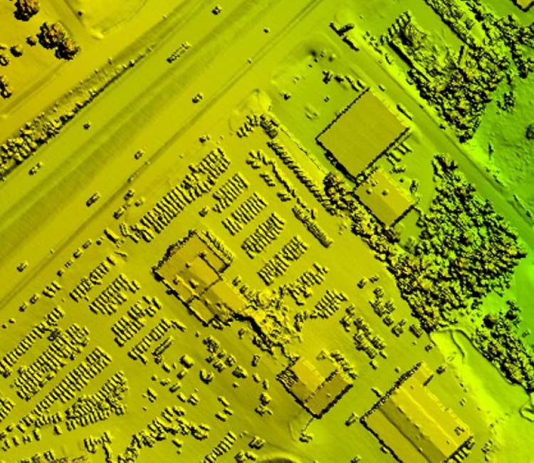
Airborne LiDAR is a type of LiDAR data that is collected from an aircraft flying over an area of interest. This data is commonly used for topographic mapping, forestry, and land-use planning. Airborne LiDAR has the following advantages:
Advantages
- High spatial coverage: Airborne LiDAR can cover large areas quickly, which makes it ideal for mapping large regions or areas with difficult terrain, rural or urban.
- High point density: Airborne LiDAR can collect a large number of data points per unit area, which makes it ideal for mapping detailed topography and vegetation structure. The point density can be set via the sensor and altered in post processing, depending on client requirements.
- Non-destructive: Airborne LiDAR is non-destructive and does not require physical contact with the ground, which means that it can be used in areas with sensitive ecosystems or where access is difficult.
Disadvantages
- Cost: Airborne LiDAR is typically more expensive than other LiDAR data types due to the need for specialized equipment and aircraft.
- Weather-dependent: Airborne LiDAR data collection is affected by weather conditions, such as cloud cover, rain, or snow which can limit data quality and availability.
- Level of detail: Airborne LiDAR data can have limited vertical accuracy in areas with dense vegetation or complex terrain, which can result in errors in elevation measurements. LiDAR is a line of sight remote sensing technology and may be an the mercy of angles and obstructions. Thick vegetation such as healthy tree canopies or grassy marshlands make it difficult to collect true ground measurements as vegetation and water absorb rather than reflect LiDAR.
Terrestrial LiDAR
Terrestrial LiDAR is a type of LiDAR data that is collected using a stationary scanner mounted on a tripod or vehicle. This data is commonly used for building information modeling (BIM), cultural heritage documentation,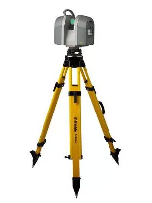 and infrastructure monitoring. Terrestrial LiDAR has the following advantages:
Advantages
- High accuracy: Terrestrial LiDAR can achieve high levels of accuracy and precision, which makes it ideal for measuring and modeling objects with complex shapes and geometry.
- High resolution: Terrestrial LiDAR can capture high-resolution data, which makes it ideal for detailed analysis and visualization. Can be paired with imagery to provide a colorized 3D environment.
- Flexible: Terrestrial LiDAR can be used in a variety of environments, including indoors and outdoors, and can be easily moved from one location to another. Usually only requires one operator and is typically a low-cost collection.
Disadvantages
- Limited coverage: Terrestrial LiDAR has a limited field of view and coverage area, which means that it may not be suitable for large-scale mapping projects. The high level of accuracy and detail comes at the cost of range. Only class 1 and 2 lasers are allowed to be used in and during heavily populated areas.
- Time-consuming: Terrestrial LiDAR data collection can be time-consuming, especially when scanning complex objects or structures. The more complex a structure, the more scans needed for consistent coverage.
Mobile LiDAR
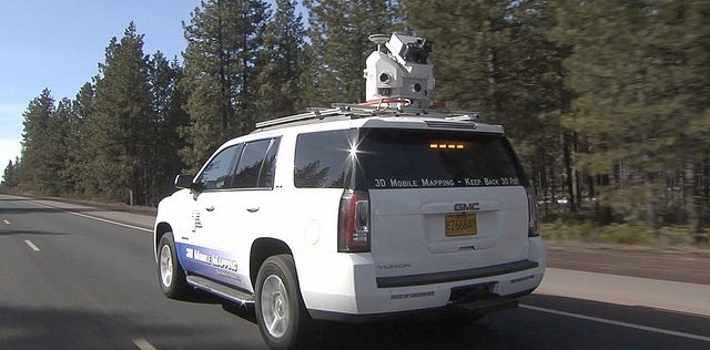 Mobile LiDAR is a type of LiDAR data that is collected using a vehicle-mounted scanner. This data is commonly used for transportation infrastructure management and autonomous vehicle navigation. Mobile LiDAR has the following advantages:
Advantages
- High speed: Mobile LiDAR can collect data quickly while the vehicle is in motion, which makes it ideal for collecting data over large areas or areas that are hazardous for the boots on ground personal.
- Wide coverage: Mobile LiDAR can capture data from a wide field of view, which makes it ideal for mapping transportation infrastructure, such as roads, highways, railways, airport runways, tunnels and more.
- Detailed coverage: Depending on sensor type and speed, a high degree of detail and can analyzed from mobile LiDAR. Usually paired with 2 to 6 cameras, systems collect high quality data making it easy to identify, design and attribute a large variety of features.
Disadvantages
- Limited accuracy: Mobile LiDAR may have limited accuracy compared to other LiDAR data types due to the movement of the vehicle and is an vulnerable to weather as airborne LiDAR.
- Noise: Mobile LiDAR can be vulnerable to noise artifacts water, snow, fog, and very reflective surfaces, making the point cloud overly dense and clouding the true features scanned. Mobile LiDAR can become too dense if not handled in the field properly.
- Line of Sight limitations: Like every other LiDAR system, line of sight in varying environmental conditions can limit the range and clarity of the point cloud. If driving on a highway, traffic including semi-trucks can obscure the edge of pavement collections. This requires a large a lot of route planning to maintain efficiency in the field.
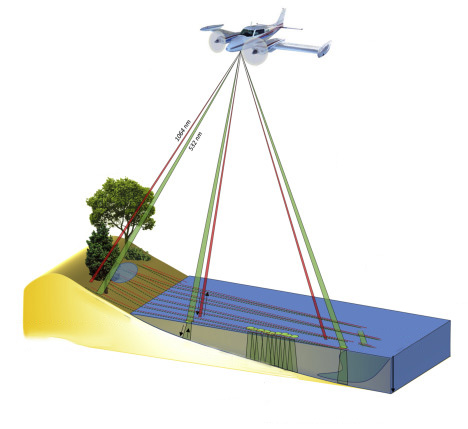 Bathymetric LiDAR is a form or subcategory of Airborne LiDAR that is only used for shoreline and shallow sea areas. It is capable of sending and receiving waveforms through water, reflecting back the true ground measurement of the sea floor. The advantages and disadvantages are similar to normal Airborne LiDAR with the added limitation that the wavelength can only penetrate the water to a certain depth.
To summarize, the three main types of LiDAR data are airborne LiDAR, terrestrial LiDAR, and mobile LiDAR. Each type has its own advantages and disadvantages depending on the specific application and project requirements.
Airborne LiDAR is ideal for mapping large areas quickly and collecting detailed topographic and vegetation data but can be expensive and affected by weather conditions. Terrestrial LiDAR is useful for measuring and modeling complex objects and structures with high accuracy and precision but can be time-consuming and have limited coverage. Mobile LiDAR can collect data quickly over large areas, making it ideal for mapping transportation infrastructure, but may have limited range and precision based on environmental factors.
In conclusion, the choice of LiDAR data type will depend on the specific requirements of each project, including the size and complexity of the area to be mapped, the level of accuracy and precision required, and the budget and resources available. Understanding the advantages and disadvantages of each type of LiDAR data is essential in selecting the most appropriate data type for a given project.
