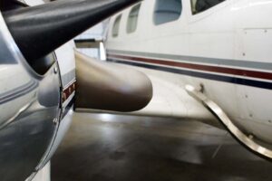
What makes a survey plane special?
 When it comes to collecting geospatial data from the air, there are a lot of options to choose from. You could use a helicopter, a drone, or even a regular plane. But if you’re looking for a fast, efficient, and precise way to collect data, a survey plane is the way to go. Here’s why:
Camera Hole or Sensor Equipment Mounting Ability
One of the key differences between survey planes and regular planes is their ability to mount specialized geospatial sensors and cameras. Survey planes are typically equipped with a camera hole or mounting system that allows for the installation of advanced sensors and cameras such as LiDAR, photogrammetry, and multispectral sensors.
LiDAR, for example, is an advanced sensor that uses lasers to measure the distance between the plane and the ground. This allows survey planes to create detailed 3D maps of the terrain, which are useful in a variety of industries, from mining and construction to forestry and environmental monitoring.
High Endurance, Speed, or Both for Large Area Coverage
Another key advantage of survey planes is their ability to cover large areas quickly and efficiently. Survey planes are typically designed for high endurance and speed, which allows them to cover hundreds or even thousands of square miles in a single flight.
This makes survey planes ideal for tasks such as aerial photography, mapping, and disaster response. For example, survey planes can be used to quickly assess the extent of damage caused by natural disasters such as hurricanes and wildfires. They can also be used to create detailed maps of large areas, which can be useful in industries such as agriculture and forestry.
G oing to/from airports for fuel is generally wasteful
Survey planes are also designed to operate for extended periods of time without the need to return to an airport for refueling. This is achieved through the use of advanced fuel-efficient engines and large fuel tanks that can carry enough fuel to keep the plane in the air for several hours.
This is a major advantage over regular planes, which typically require frequent refueling stops. The ability to stay in the air for longer periods of time allows survey planes to cover larger areas and collect more data in a single flight.
Payload to Transport Support Equipment and Crew Supplies for Long Trips
Finally, survey planes are designed to transport not just their specialized geospatial equipment, but also the support equipment and crew supplies needed for long trips. This includes things like spare parts, tools, and crew luggage.
This makes survey planes ideal for tasks that require extended periods of time in the air, such as mapping large areas or conducting environmental surveys. The ability to transport all of the necessary equipment and supplies on board the plane reduces the need for frequent stops and allows the survey team to work more efficiently.
So while regular planes may be suitable for some geospatial tasks, survey planes are a unique and specialized tool that offer a range of advantages over other types of aircraft. From their ability to mount specialized geospatial sensors to their high endurance and speed, survey planes are the ideal choice for anyone looking to collect fast, precise, and efficient geospatial data from the air.


