How NOT to Procure Geospatial Solutions
As you prepare for a new year and a new budget, Aerial Services, Inc. (ASI) would like to share with our guide on how NOT to procure geospatial services.
The Onslaught of AI and Implications for the Geospatial Professional

By the 2040s we will have the opportunity to apply the accumulated knowledge and skills of our civilization to computational platforms that are billions of times more capable than unassisted biological human intelligence. (Kurzweil, 2005) Kurzweil continues saying “The advent of strong AI is the most important transformation this century will see and comparable in importance to the advent of biology itself. It will mean that a creation of biology has finally mastered its own intelligence and discovered means to overcome its limitations.”
HEIGHTS 2022

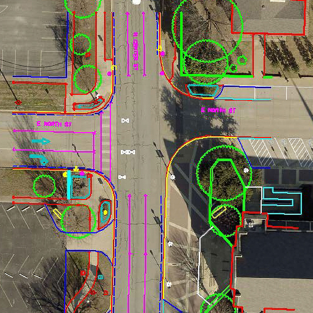
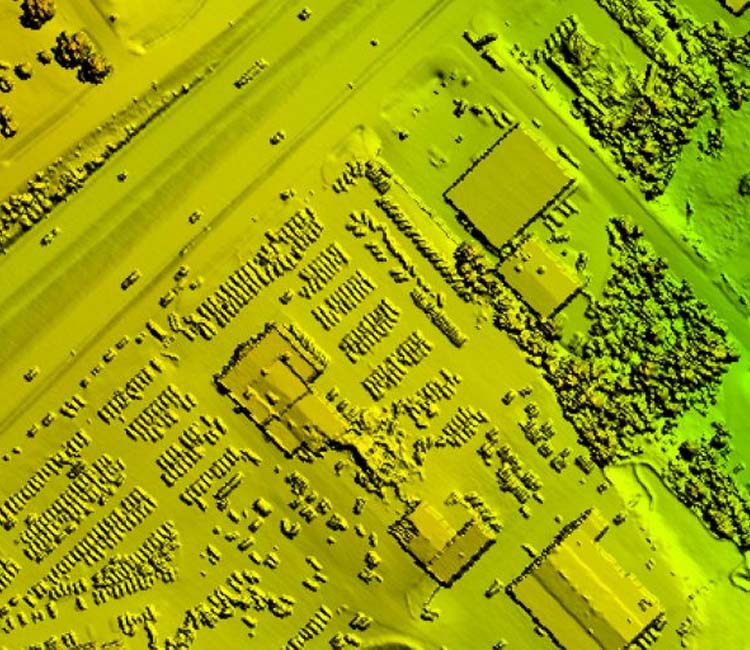
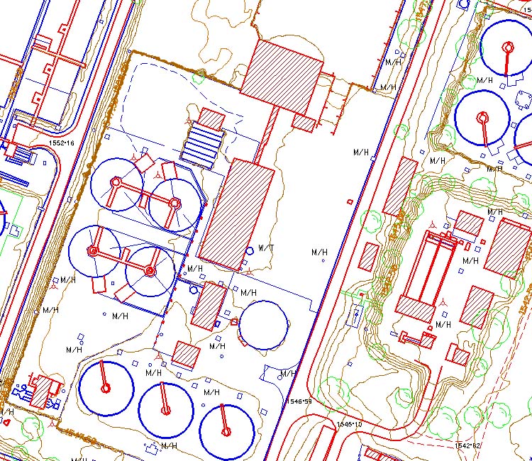
ASI provides rapid turnaround and high-quality mapping of feature conditions to assist utility engineers throughout the design/inspection process. ASI’s utility mapping experts have performed hundreds of jobs nationwide, from mapping of business park-level node sites to transmission line corridors stretching thousands of miles.
ASI Begins Work on USDA’s 5 Year Blanket Purchase Agreement (BPA)
ASI will compete to provide high-resolution, vertical imagery to support various Farm Production and Conservation (FPAC) geographic information system (GIS) programs, including but not limited to resource management, conservation programs, crop compliance, and disaster response.
ASI Provides Rapid Turnaround of Geospatial Solutions With the Help of “Alpha”

Alpha is a web-based application developed in-house as part of a collaborative effort between ASI flight, production, and programming professionals. Alpha was developed by our teams to provide greater visibility of every project that ASI takes on.
Aerial Services Awarded Five-Year USDA PINE Aerial Imagery Blanket Purchase Agreement
Under the blanket purchase agreement (BPA), ASI will compete to provide high-resolution, vertical imagery to support various Farm Production and Conservation (FPAC) geographic information system (GIS) programs, including but not limited to resource management, conservation programs, crop compliance, and disaster response.
MAPPS Presidents Award Won for 7th Consecutive Year!
Mike Tully, CEO of Aerial Services Inc., was presented with the MAPPS President’s Award by the MAPPS President Susan Marlow (Stantec, Nashville, TN). This marks the 7th consecutive year Mike has been the recipient of the award. Mike’s dedication and service as the Program Committee Chairman was recognized by the President of MAPPS.
ASI to Acquire QL2+ LiDAR for USGS
The QL2+ lidar data will be processed by Aerial Services to provide USGS, its partner the Natural Resources Conservation Service (NRCS), and regional stakeholders with updated topographic mapping. The project area spans across Bond, Calhoun, Clay, Clinton, Effingham, Fayette, Jackson, Jefferson, Jersey, Macon, Marion, Moultrie, Perry, Richland, Shelby, Vermilion, and Washington counties.
Aerial Services, Inc. Acquires Aerial Mapping Solutions (AMS)
Combining AMS’s niche utility industry expertise with ASI’s history providing engineers with aerial mapping solutions will allow ASI to continue innovating new ways to best serve clients.